komoka village weather
Latitude N 42° 57' 36" Longitude W 81° 26' 18" Elevation 827 ft
| Dawn: | 05:37 | Sunrise: | 06:09 | Moonrise: | 02:35 |  |
| Dusk: | 21:07 | Sunset: | 20:35 | Moonset: | 12:25 | |
| Daylight: | 15:30 | Day length: | 14:26 | Moon Phase: | Waning Gibbous |
|
|
Sun Plot: Sunrise, Sky/ Sunshine, Current Sun position, and Sunset |
Dawn / Dusk Created Through Courtesy the beteljuice
Day/Night and Sun Plot Images Created Through Courtesy of Mark Crossley
Welcome to Komoka, ON Canada (just west of London, Ontario).
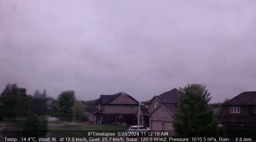
The weather station in use is the Davis Vantage Pro 2 Plus with 24-Hr FARS, and the data is updated every 5. The meteorological day used at this station ends at midnight. Addional equipment in use are Logitech webcam
Davis Station Forecast: Mostly cloudy and cooler. Precipitation possible within 12 hours, possibly heavy at times. Windy.
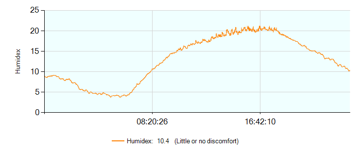
| Temperature and Humidity | |||
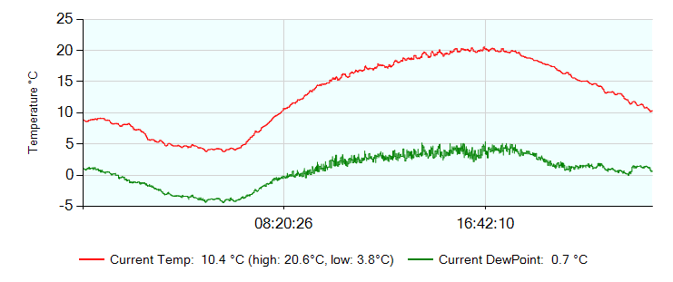
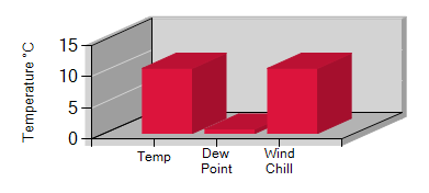
| Temperature | 10.0 °C | Dew Point | 0.0 °C |
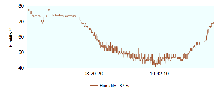
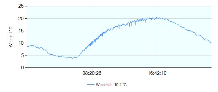
| Windchill | 10.0 °C | Humidity | 66% |
| Heat Index | 10.0 °C | Apparent Temperature | 7.4 °C |
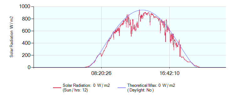
| Solar Radiation | 35 W/m² | Evapotranspiration Today | 0.36 mm |
| Sunshine Today | 0.4 hours | Sunshine Yesterday: | 12.5 hours |
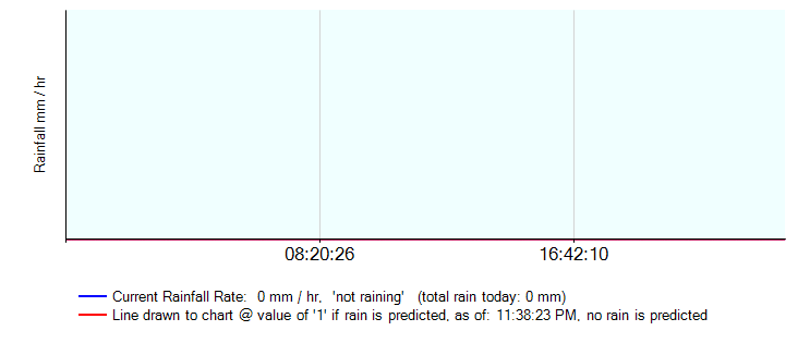
| Rainfall and Snow | |||
| Rainfall Today | 0.0 mm | Rainfall Rate | 0.0 mm/hr |
| Rainfall This Month | 2.8 mm | Rainfall This Year | 243.4 mm |
| Rainfall Last Hour | 0.0 mm | Last Rainfall | 2026-05-06 01:57 |
| Rainfall Since Midnight | 0.0 mm | Rainfall Last 24 Hours | 0.0 mm |
| Snowfall To 9:00 am | cm | Snow On Ground 9:00 am | 0 cm |
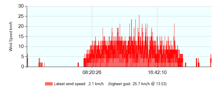
| Wind | |||
| Wind Speed (gust) | 15.0 km/h | Wind Speed (avg) | 6.4 km/h |
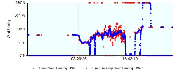
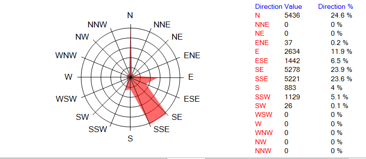
| Wind Bearing | 203°SSW | Beaufort F2 | Light breeze |
| Wind Variation (last 10 minutes) | From 181° To 225° | ||
| Pressure | |||
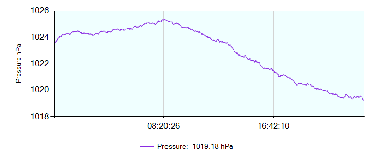
| Barometer | 1005.76 hPa | Falling slowly | -0.15 hPa/hr |
| :now: :gauges: :gauges-ss: :today/yesterday: :month: :year: :records: :monthly: :trends: :observations: :vp2-console: :vue-console: :sys-status: :forum::webcam: | |||
Page updated 09/05/2026 7:20:00 AM
powered by
Cumulus
v1.9.4 (10992)


